A practice that dissolves the boundaries between body, technology and environment, transforming space into a living, pulsating palimpsest. Every step is a line, every gesture a sign: trajectories inscribed in three dimensions are not just data, but material narratives that translate the landscape into a living work.
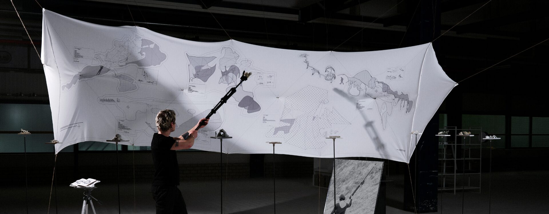
“Site drawing, from GPS tracking to architecture” is a technological methodology for spatial design (architecture, landscaping and installations).
The practice is based on the use of a GPS receiver attached to a telescopic rod that tracks the participant’s movement within a site. Like a pen on a sheet of paper, movements are recorded in three dimensions to enable spatial design with centimeter accuracy. Digital design is based solely on a simulation created from satellite images, cadastral plans or other extracted data. By designing directly in situ, the model is accurate and site-specific, eliminating the need for simulation. This practice has been influenced by a critical tool approach, an ecological focus on locality, and embodied design at the human scale. For this reason, the tool has been used within ecovillages to conduct landscape interventions, interior design, or small-scale architectural projects with residents. The participant, the climate, the number of satellites received, and the specifics of the site are all components that manifest themselves in the design.
The use of GPS for in situ architecture in communities involves a double subversion. First, it subverts the extra-planetary scale of GPS by using a system designed for a synoptic view to create artifacts readable only in relation to the context in which they are created. Second, it subverts the destructive origins of satellite navigation-born to mark places to target with precision weapons-using technology to imagine possible futures, rather than destroy the existing one.
IN COLLABORATION WITH
Michael Caplan